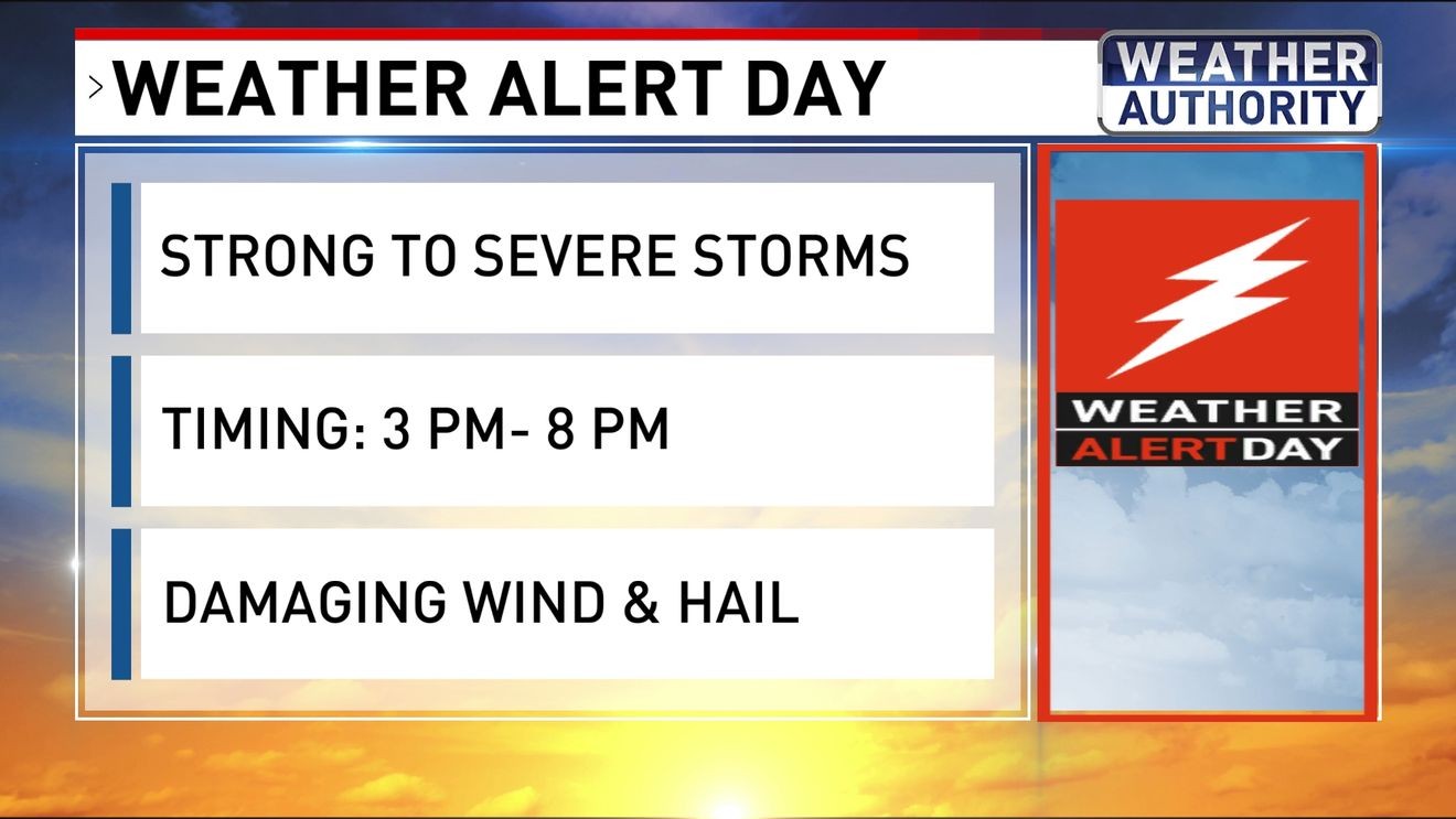
BALTIMORE (WBFF) — Tracking strong thunderstorms Sunday afternoon-evening.
We are in WEATHER ALERT mode for the storms.

Weather Alert Day
Dew point temps climb back to the uncomfortable category later today as moisture moves in from the south.
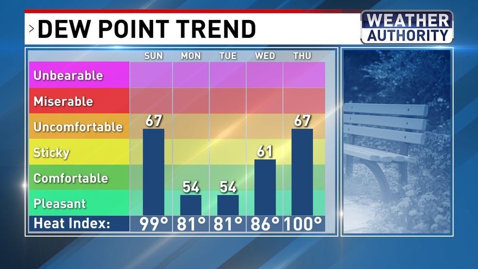
Dew Point Trend
The heat will also crank up, with highs well into the 90s.
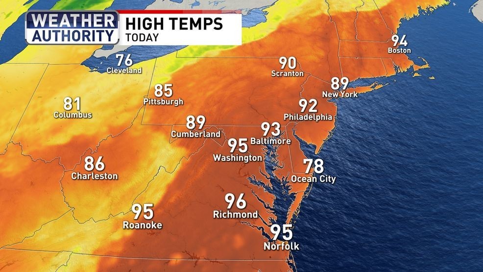
High Temps Sunday
The combination of heat and humidity will get the atmosphere juiced up for storms to develop Sunday afternoon.
More than 70 million Americans are under a SLIGHT risk (2 out of 5) for storms from the Storm Prediction Center.

Severe Thunderstorm Forecast
That risk covers the entire state of Maryland, meaning storms are likely.

Severe Thunderstorm Forecast
The main threat for storms looks to be later Sunday afternoon into the evening.
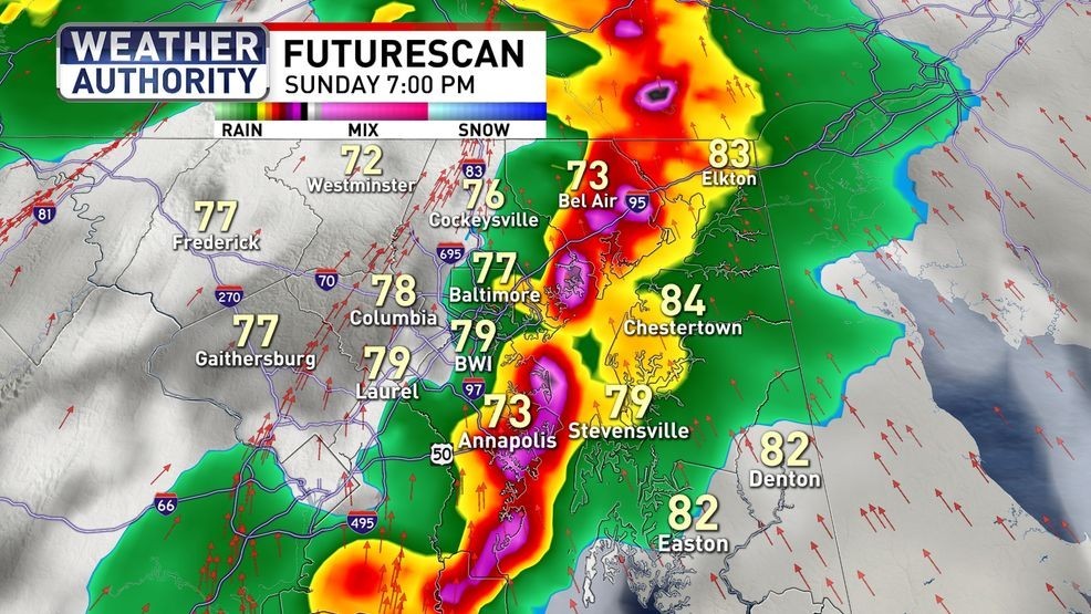
Futurescan Sunday PM
Damaging winds at 60-70 mph are the biggest threat.
We do have a low end threat for an isolated tornado as well.
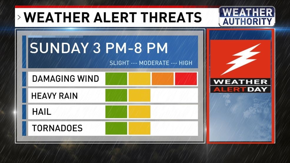
Severe Weather Threats
After the storms pass, we get a nice break from the summer heat Monday and Tuesday.
BE THE FIRST TO COMMENT
More storms on the way Thursday.
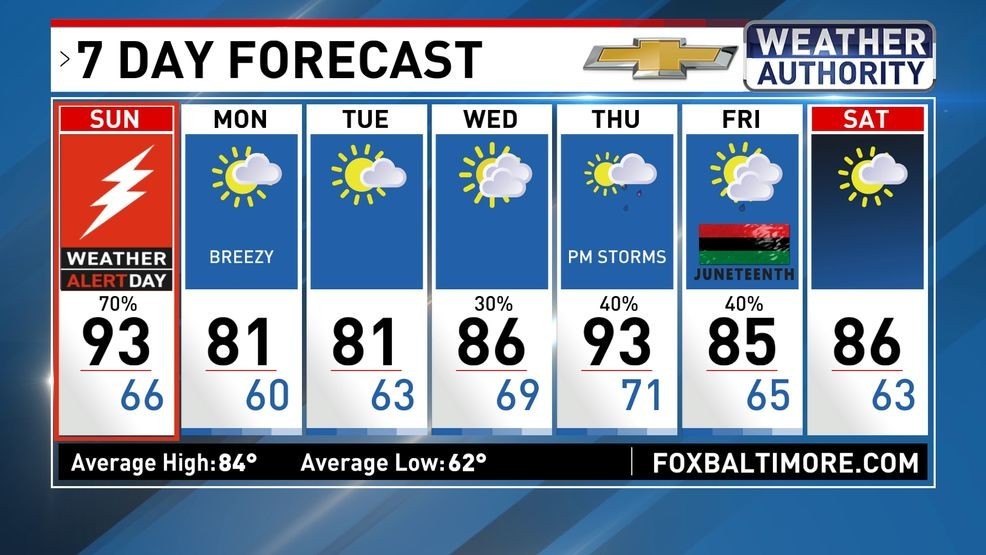
7 Day Forecast