BALTIMORE (WBFF) — Updated 7:00 a.m. February 20 — A sizable storm is likely Sunday with the potential for several inches of snow in Maryland.
Sunday snowstorm{ }
There is still disagreement with forecast models on the strength and track of the storm.
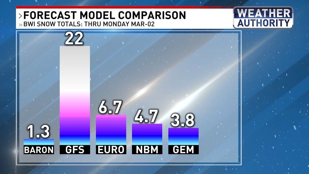
Here’s a look at what the different forecast models are showing:
Forecast models{ }
The GFS (Global Forecast System) is showing a high-impact but low confidence scenario with up to 2 feet of snowfall.
The EURO (European Model) indicates a more tame storm but still shows impactful accumulations up to 6″ of snow.
The NBM (National Blend of Models) updates more frequently and combines 20+ models and lots of observations and shows the most statically likely forecast. Currently showing around 5″ of snowfall.
TIMELINE
Weekend weather-maker
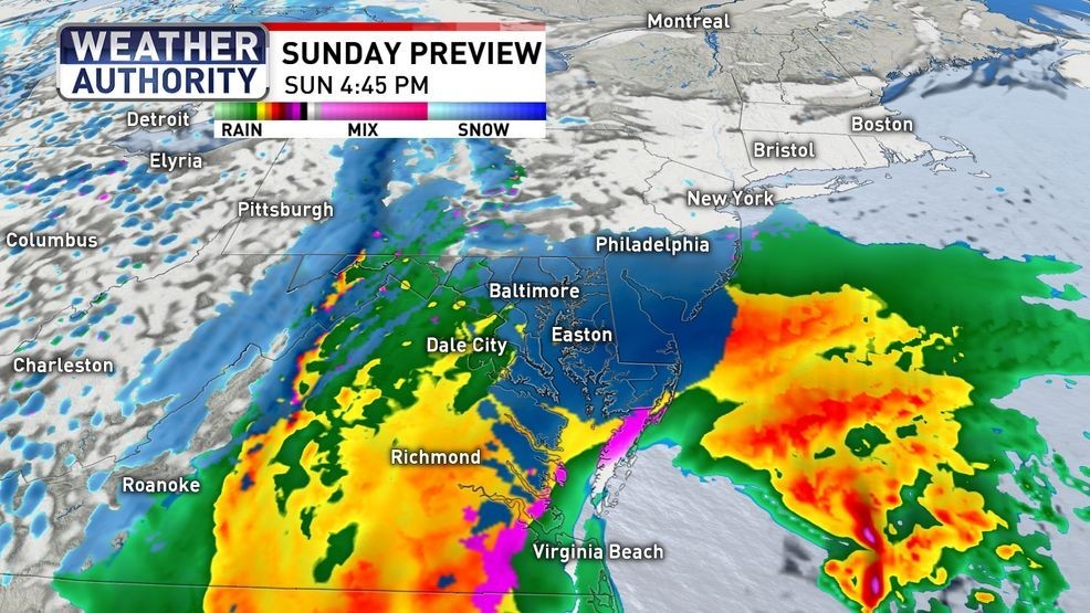
As it stands now, a chilly rain/snow mix develops early Sunday with a wet snow likely by Sunday evening and night into Monday morning.
SNOWFALL POTENTIAL

Snow totals
The models show a wide range of 1″ up to 2′ of snowfall. Most likely we’ll end up with 1-3″ of snowfall with the potential for up to 6″ of snow. Most of the stickage will occur after sunset since ground will be warmer during the day from recent rain and temperatures in the 50s leading up to the storm.
IMPACTS

Weekend weather
BE THE FIRST TO COMMENT
Impacts will continue into Monday morning with delays possible due to below freezing temperatures and slick conditions.