BALTIMORE (WBFF) — The big question this weekend is how much snow Maryland could see. While forecasters usually have a good idea two days out, this next system is bringing challenges. Why? Huge differences between forecast models.

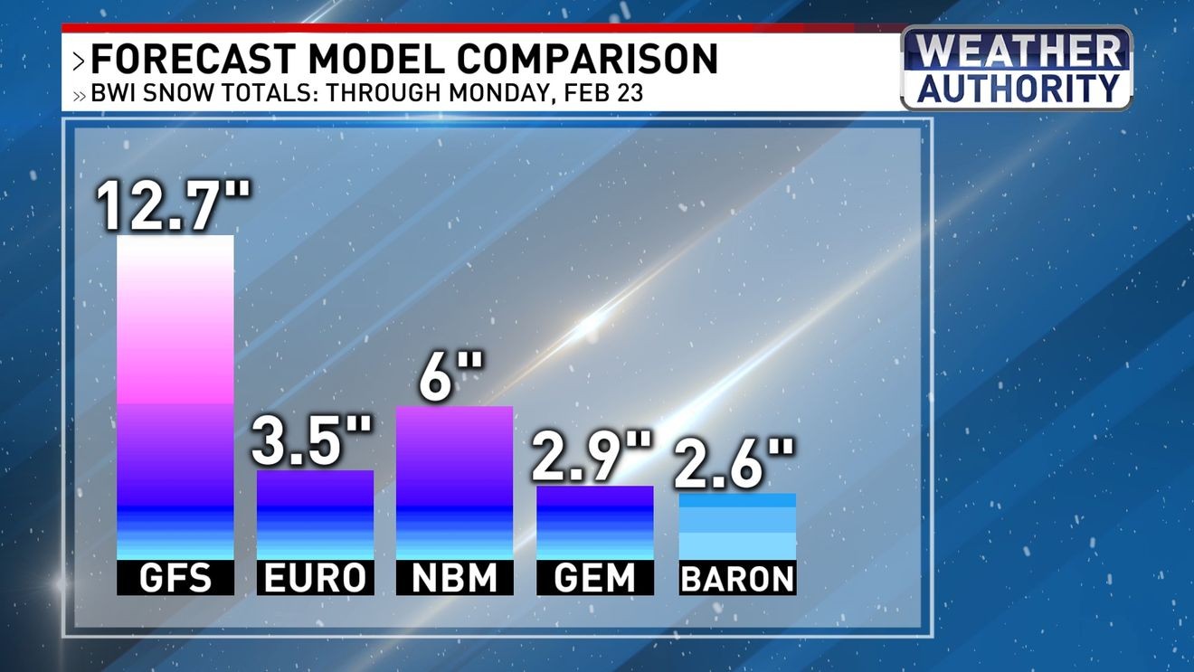
Forecast Model Comparison
Common models that meteorologists use include the GFS, Euro, NBM and sometimes the Canadian model.
The GFS stands for Global Forecast System and is sometimes referred to as the American model.
The Euro or European model is a nickname for the European Centre for Medium-Range Weather Forecasts (ECMWF) model.
NBM stands for National Blend of Models, and as its name suggests, it blends different models to create a forecast.
The Canadian is also called the GEM, Global Environmental Multiscale Model.
Here at Fox45, a model called Baron 3km is also used. It is a high resolution weather model exclusive to Baron, the graphics system Fox45 uses. Right now, all these models have different forecasts for the Baltimore area through Monday morning.
GFS: 12.7″
Euro: 3.5″
NBM: 6.0″
Canadian: 2.9″
Baron 3km: 2.6″
The difference in numbers is based on differences in track of the potential storm system. The GFS puts a low-pressure system very close Maryland’s coast Sunday afternoon. The Euro, Canadian and Baron models put the low farther into the Atlantic. These differences may seem small, but they make for huge forecasting disparities. A low close to the coast means more snow. A low farther from the coast means less snow.

Weekend Weather-Maker GFS
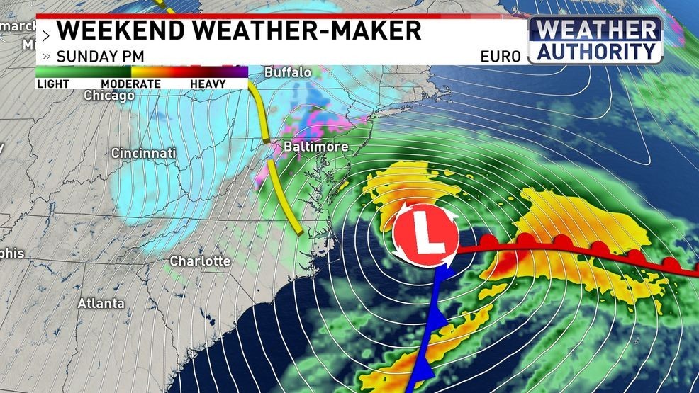
Weekend Weather-Maker Euro
Temperatures are also an important factor with this forecast. Ground temperatures may not be cold enough for snow accumulation initially. This means that while four inches of snow may fall in one location, all of it may not stick, so temperatures will play a huge role in when snow falls and how much will stick.
For example, the GFS has temperatures near freezing at 3 p.m. with snow falling. On the other hand, the Euro has temperatures in the mid 30s with mostly rain falling.

Futurescan GFS

Futurescan Euro
The Fox45 Weather Authority uses all of this information and years of experience to discern most likely scenarios. We know which models typically perform better and under what circumstances they do well. We also compare models to find outliers, and we check model runs to see if there is any consistency.
Our team knows that a chilly rain is likely Sunday morning. In the afternoon, a rain and snow mix is possible with little snow accumulation. As temperatures fall below freezing Sunday night into Monday morning, snow will fall and accumulate. The current prediction is 2-5″ across the Baltimore area with lower totals south and higher totals north.
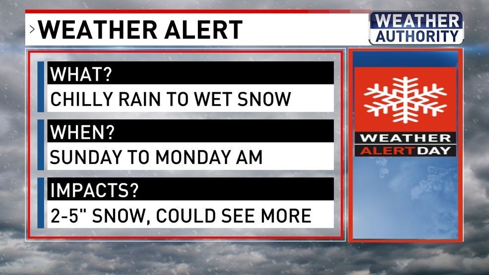
Weather Alert Headlines