BALTIMORE (WBFF) — After a quiet day Sunday, more strong storms move in Monday.
Our next weather maker will put us into Weather Alert mode.

Next Weather Maker
The severe thunderstorm forecast is a 4 out of 5 for millions of people up and down the East Coast.

Severe Thunderstorm Forecast
You can see that portions of our area are under a SIGNIFICANT threat for severe storms Monday afternoon.
This is a rare MODERATE risk from the Storm Prediction Center.
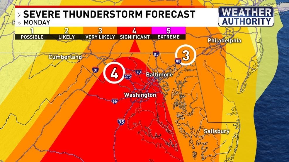
Severe Thunderstorm Forecast
Even the tornado threat level is high for those in the dark shaded areas.
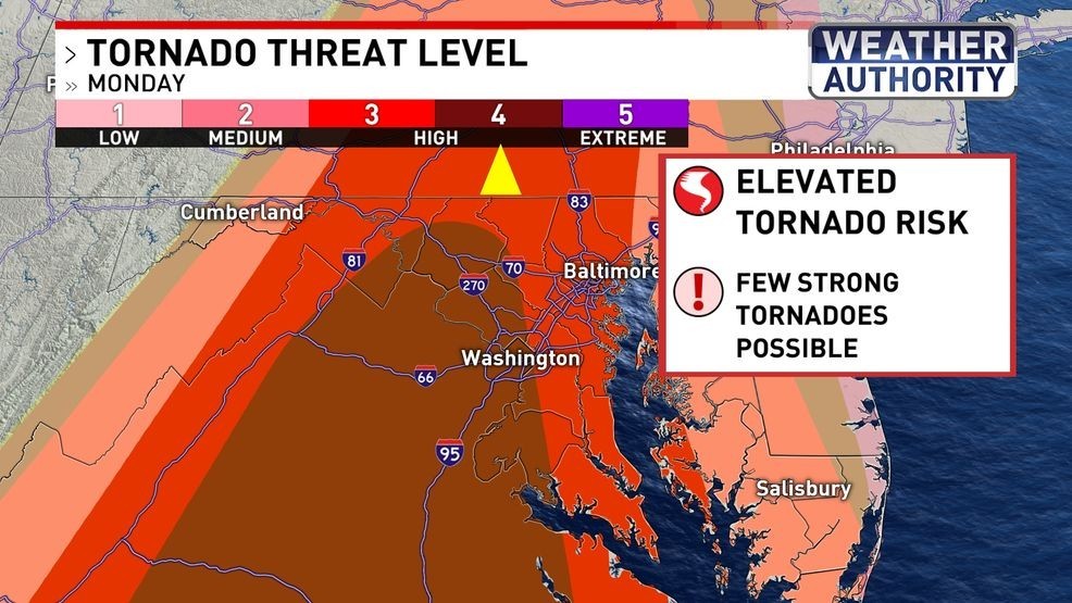
Tornado Threat Level
Damaging straight line winds and multiple tornadoes are the biggest threats we are facing Monday afternoon.

Weather Alert Threats
The strong cold front will run into warmer and moisture-laden air.
That will lead to strong updrafts and possible straight line winds with tornadoes possible as well.

Futurescan Monday Afternoon
Temps will nosedive after the front passes on Tuesday before they level off later in the week.
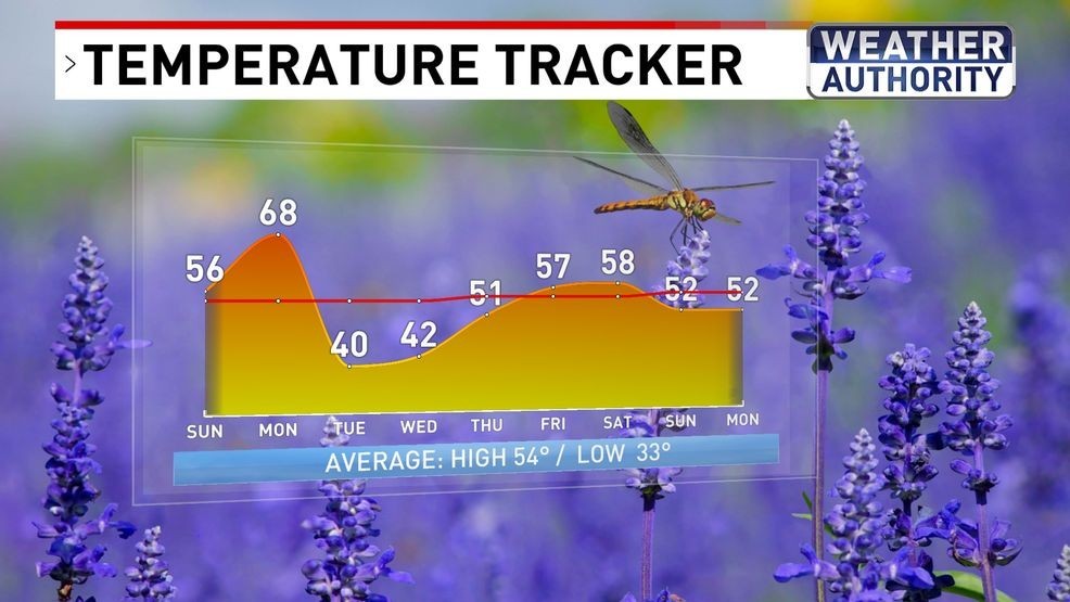
Temperature Tracker
BE THE FIRST TO COMMENT
Cold and windy for St. Pat’s Day, but nicer for the first day of spring Friday.
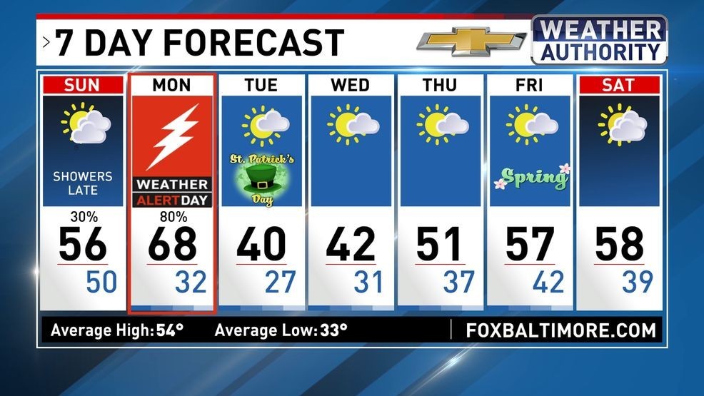
7 Day Forecast