BALTIMORE (WBFF) — Temperatures remain below average today as an unsettled pattern continues, but drier weather and scorching temperatures are on the way.
Scattered showers and storms are possible today as a stalled front remains overhead. Today will not be a washout, but showers could have an impact on afternoon plans. Overnight, rain will taper.
Futurescan
High temperatures today will reach the low to mid 80s. Skies will be mostly cloudy.

Afternoon Planner
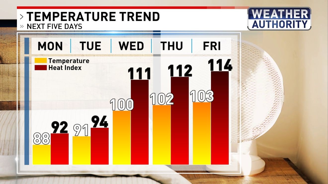
A big change in temperatures will come as June ends and July begins. First, highs will reach the upper 80s and low 90s on Monday and Tuesday. The rest of the week will be scorching hot with highs reaching the upper 90s and 100s. These days will bring dangerous heat and humidity with heat indices over 110. Be sure to practice heat safety.

Temperature Trend
It is not every year that BWI Airport records a temperature at or above 100. The last time it happened was in 2024, a year with eight days at or above 100. In the recent years with 100-days before 2024, there were only one or two days when highs reached the hundreds.

Past Years with 100° Temperatures
BE THE FIRST TO COMMENT
Most of this week will be dry, but some showers and storms are possible on the Fourth of July. It is too early to know timing and impacts, so be sure to follow along for updates.

7 Day Forecast