BALTIMORE (WBFF) — Hot and humid with more afternoon thunderstorms rolling in.
The Next Weather Maker will move in Saturday afternoon into the evening.

Next Weather Maker
It should be a good day to be on the water, just watch for the storms later in the day.
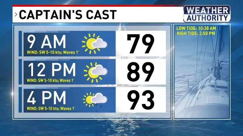
Captain’s Cast
Highs are back into the 90s for the third day in a row.

Day Planner
These temps are above average for early August.

High Temps Saturday
Dewpoint numbers stay elevated Saturday before backing off a bit Sunday and Monday.
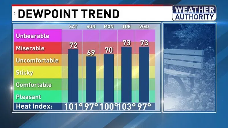
Dewpoint Trend
The Storm Prediction Center now has our area under a SLIGHT risk (2 out of 5) for storms, meaning storms are likely.
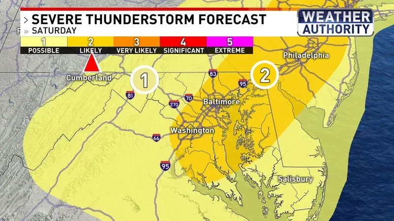
Severe Thunderstorm Forecast
Most of the storm activity will be after 2 pm Saturday.
Damaging wind and heavy rain will be the biggest threats we see from these storms.
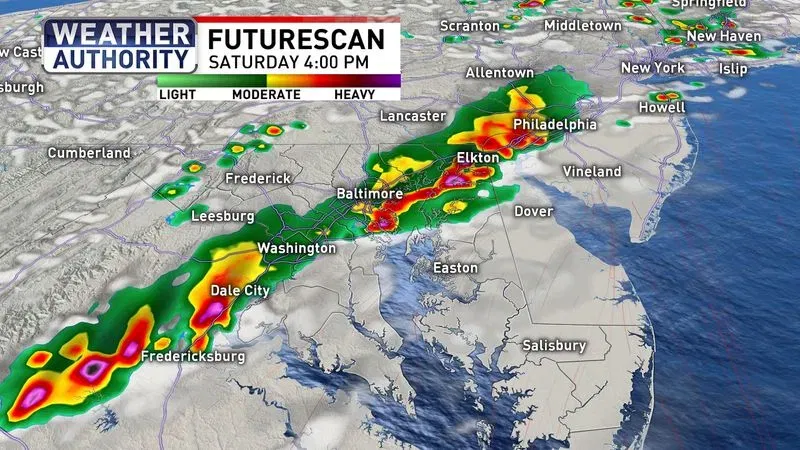
Futurescan Saturday PM
If you’re heading to the beaches, temps will be a bit cooler this weekend.

Down The Ocean Cast
We keep the 90s around until next Tuesday.
There will be more storms by the middle of next week, with cooler temps for next weekend.
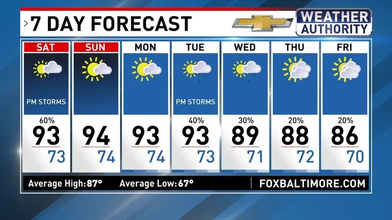
7 Day Forecast
 Local Story